Menu:
- Home
- TAC-G
- Calendar
- Cybersecurity
-
Projects
- Plans & Documents
- Tribal Medical Reserve Corps
- Tribal CERT
- Tribal RACES
-
Blockwatch
-
Interoperable Communications
- Nation to Nation
- Legislative
- Links
- Grant Opportunities
- Critical Infrastructure Protection
-
Tribal Public Health
- Tribal GIS
-
Public Information Officers
- Upcoming and Past Conferences
![]()
Upcoming Events
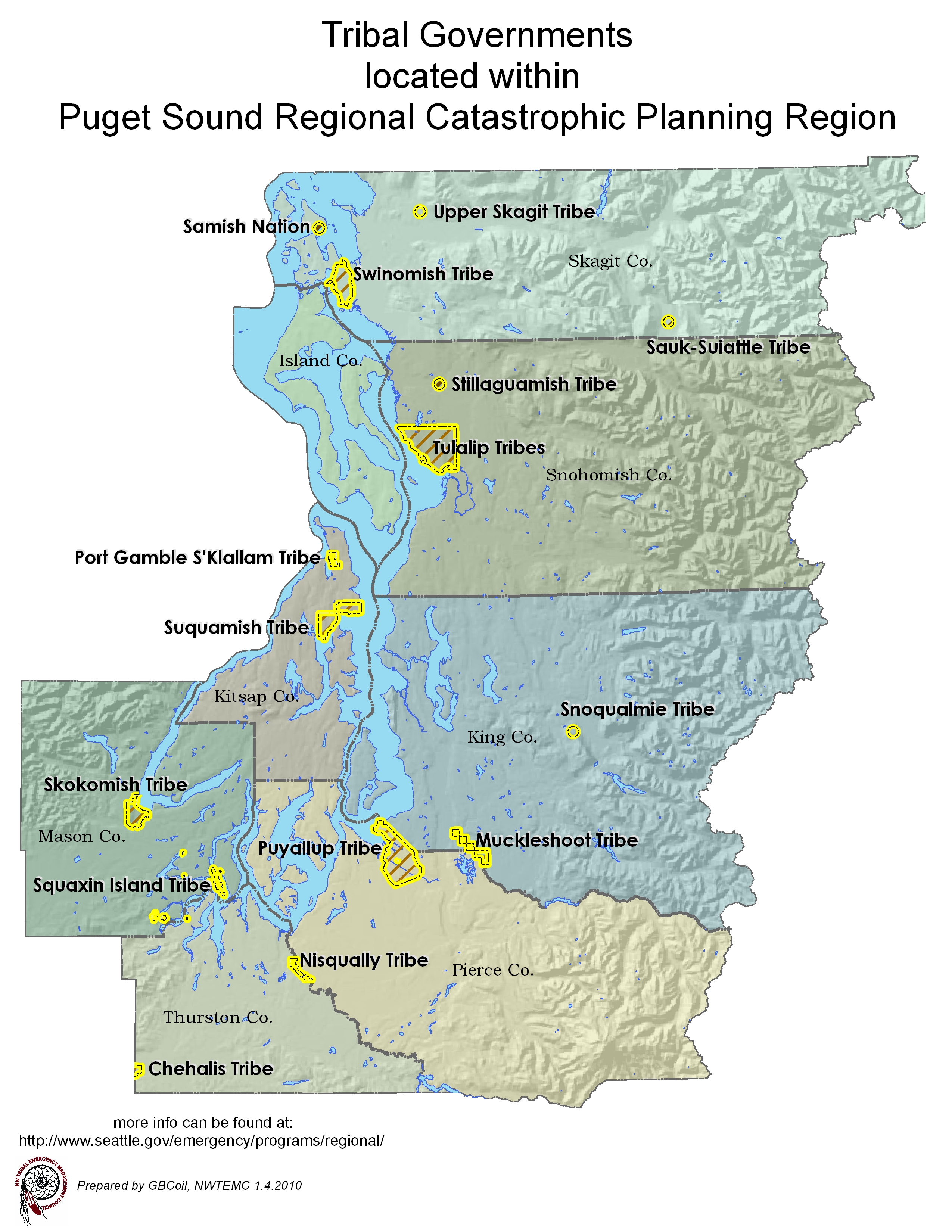
NWTEMC Tribal Partners
Colville Confederated Tribes
Coeur D'Alene Tribe
Cow Creek Band of Umpqua Tribe of Indians
Cowlitz Indian Tribe
Hoh Indian Tribe
Kalispel Tribe of Indians
Lower Elwha Klallam
Lummi Nation
Muckleshoot Indian Tribe
Nez Perce Tribe
Nisqually Indian Tribe

Nooksack Indian Tribe
Quinault Indian Nation
Quileute Nation

Samish Indian Nation

Sauk-Suiattle Indian Tribe
Scammon Bay Native Village, Alaska
Shoshone-Bannock Tribes
Confederated Tribes of Siletz Indians
Spokane Tribe of Indians
Stillaguamish Tribe of Indians

Swinomish Indian Tribal Community

Tulalip Tribes

Upper Skagit Tribe
Village Council of Mekoryuk, Alaska
Welcome to NWTEMC's GIS/Mapping page. Below you will find
links to map viewers, maps and GIS data layers for Natural Hazards.
Map viewer links:
http://mapper.acme.com/
Two Maps One Scale
View two different locations at the same zoom level, to compare sizes.
powered by google maps, also has USGS top and DOQ layers
Maps - sample of maps created by NWTEMC, unless noted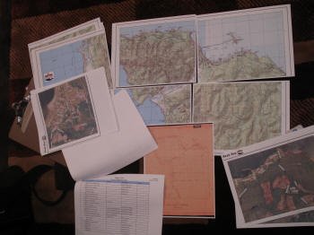
Map viewer links:
http://mapper.acme.com/
powered by google maps, also has USGS top and DOQ layers
Maps - sample of maps created by NWTEMC, unless noted
2009 NWTEMC Conference Poster: Tribal Lands of WA, ID & OR (unfinished DRAFT) 30mb
![Map of Oregon [and WA] showing the location of Indian Tribes. 1852](images/maps/wsu588_Oregon_tribes_57.jpg)
GIS data sources for Hazards Mapping/Risk Assessment
Data is in ESRI shapefile unless noted
Washington State:
WA DNR has Landslide, Tsunami, Liquefaction Susceptibility, NEHRP Soil Classes
and Seismic Design Class layers on its Surface Geology data page. This link will take you to there:
WA DNR Hazards & Environmental Geology
Direct links are below:
Earthquakes
Liquefaction Susceptibility: definitions found in metadata
NEHRP Seismic Site Class: Definitions can be found in metadata
Tsunami
Tsunami Inundation DNR layer of Tsunami Inundation based on 2 Cascadia Scenarios
Landslide Inventory
WA landslides 1:24,00 Scale: DNR Layer of past landslides
The following info is found at DNR Forest Practices GIS Spatial Datasets:
Hazard Zones
This layer shows Landslide Hazard Zones by likelihood of Instability.
For mapping, the important field is INTERP_INSTAB_CD. This can be labeled as:
| Value: 1 | Definition: low likelihood of instability |
| Value: 2 | Definition: moderate instability potential |
| Value: 3 | Definition: high delivery potential |
| Value:4 | Definition: very high instability potential |
| Value: 9 | Definition: indeterminate instability potential (should be rarely used) |
| Value: 8 | Definition: Variable (landforms of concern) |
| Value: 0 | No Info |
The field INTERP_DELIVR_CD should also be considered as its defined as:
"Analyst observed/interpreted ability to deliver debris to a resource or threaten public safety"
The coding for this can be found in the metadata
Forest Practices Landslides A Another DNR Forest database of past landslides
FEMA Floodplains
WA Dept. of Ecology FEMA Digital Flood Data (note: in .eoo format, needs to be converted using arc catalog (make sure ArcView 8x Tools in View>Toolbars is activated then conversion tools>Import from interchange file)
Wildfires
This info found at DNR GIS: Wildfire & Prevention:
DNR Fire Stats 1970-2007
DNR Fire Stats 2008-Present
Wildland/Urban Interface High Risk Communities
DOE Sites of Interest, Tier II Reporters etc.
DOE Facility Site (Ecology Permitted Sites)
Used for mapping hazmat related events and potential sources.
This layer shows a location or operation of interest to Ecology that has an active or potential impact on the environment.
This includes:
- State Cleanup sites
- Federal Superfund sites
- Hazardous Waste Generators
- Solid Waste Facilities
- Underground Storage Tanks
- Dairies
- Enforcement
Marine Oil Spill Planning
info: Geographic Response Plan (gis layer)
Geographic Response Plan (GRP): Strategies, Spill Origins, & Sector Maps (3
layers)
Spill Prevention,
Preparedness, and Response Website
Volcanoes
Digital data set of volcano hazards for active Cascade Volcanoes, Washington
USGS Cascades Volcano Observatory
-This dataset has all the blast zones, lahar inundation and
tephra ash clouds for the 5 WA volcanoes
(note: in .eoo format, needs to be converted using arc catalog (make sure ArcView 8x Tools in View>Toolbars is activated then conversion tools>Import from interchange file)
Other data:
lidar topographic data:
View Larger Map

Last updated: Friday, October 28, 2016