Menu:
- Home
- TAC-G
- Calendar
- Cybersecurity
-
Projects
- Plans & Documents
- Tribal Medical Reserve Corps
- Tribal CERT
- Tribal RACES
-
Blockwatch
-
Interoperable Communications
- Nation to Nation
- Legislative
- Links
- Grant Opportunities
- Critical Infrastructure Protection
-
Tribal Public Health
- Tribal GIS
-
Public Information Officers
- Upcoming and Past Conferences
![]()
Upcoming Events
NWTEMC Tribal Partners
Colville Confederated Tribes
Coeur D'Alene Tribe
Cow Creek Band of Umpqua Tribe of Indians
Cowlitz Indian Tribe
Hoh Indian Tribe
Kalispel Tribe of Indians
Lower Elwha Klallam
Lummi Nation
Muckleshoot Indian Tribe
Nez Perce Tribe
Nisqually Indian Tribe

Nooksack Indian Tribe
Quinault Indian Nation
Quileute Nation

Samish Indian Nation

Sauk-Suiattle Indian Tribe
Scammon Bay Native Village, Alaska
Shoshone-Bannock Tribes
Confederated Tribes of Siletz Indians
Spokane Tribe of Indians
Stillaguamish Tribe of Indians

Swinomish Indian Tribal Community

Tulalip Tribes

Upper Skagit Tribe
Village Council of Mekoryuk, Alaska
The NWTEMC is currently assisting the Lower Elwha Klallam
Tribe to develop a Tribal Hazard Mitigation Plan. Once completed and approved by
FEMA, this plan will serve as a guide for future decision making in the Tribe's Goal to
make the tribal people and it properties safer from the effects of natural
hazards.
The Plan will be reviewed once a year and after any major disaster events. The Plan will also be incorporated into other planning and development projects.
The Plan will be updated once every five years.
This page contains all the resources and materials gathered for the development of the Plan, including early drafts, presentations and surveys.
Points of Contact:
Lower Elwha Tribe:
NW Tribal Emergency Mgmt. Council:
Glenn Coil
glenn@nwtemc.org
ph: 206-310-1467
Planning materials:
Community Hazards Survey
1st Community Presentation: Sept 9, 20009
2nd Community Presentation: August 5, 2010
Flyer for Community Meeting 8.5.2010
Mitigation Actions Review and Prioritization Workshop: May 9th, 2011
Mitigations Actions Presentation
Mitigation Prioritization Worksheet
DRAFT Goals and Objectives, Mitigation Actions
new: Now available for Public Comment:
DRAFT 2011 LEKT Plan (57 mb, large file)
Maps
General Area Map of Lower Elwha Reservation created 12.13.10
Liquefaction Risk of LEKT Reservation
FEMA 100 & 500 Yr Floodplain of Lower Reservation
NEHRP soil classification for Earthquake Hazard, Lower Reservation
Tsunami Inundation of Lower Reservation (using old data)
Tsunami Inundation up to 50 ft elevation using LIDAR data
Wildfires by Cause on Lower Reservation
(note: Maps are in Draft form, for REFERENCE USE ONLY. Maps prepared using best available data. LEKT, NWTEMC and data creators do not assume liability for inaccuracies)
Other Resources:
2010 Clallam County Hazard Mitigation Plan update
Lower Elwha Tribe's website
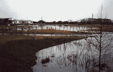
Photos:
Photos from Community meeting Aug 5, 2010
Photos from Site Visit Feb. 27, 2009
Photos from Site Visit Dec 13, 2010: New Levee on West Bank of Elwha River
The Plan will be reviewed once a year and after any major disaster events. The Plan will also be incorporated into other planning and development projects.
The Plan will be updated once every five years.
This page contains all the resources and materials gathered for the development of the Plan, including early drafts, presentations and surveys.
Points of Contact:
Lower Elwha Tribe:
NW Tribal Emergency Mgmt. Council:
Glenn Coil
glenn@nwtemc.org
ph: 206-310-1467
Planning materials:
Community Hazards Survey
1st Community Presentation: Sept 9, 20009
2nd Community Presentation: August 5, 2010
Flyer for Community Meeting 8.5.2010
Mitigation Actions Review and Prioritization Workshop: May 9th, 2011
Mitigations Actions Presentation
Mitigation Prioritization Worksheet
DRAFT Goals and Objectives, Mitigation Actions
new: Now available for Public Comment:
DRAFT 2011 LEKT Plan (57 mb, large file)
Maps
General Area Map of Lower Elwha Reservation created 12.13.10
Liquefaction Risk of LEKT Reservation
FEMA 100 & 500 Yr Floodplain of Lower Reservation
NEHRP soil classification for Earthquake Hazard, Lower Reservation
Tsunami Inundation of Lower Reservation (using old data)
Tsunami Inundation up to 50 ft elevation using LIDAR data
Wildfires by Cause on Lower Reservation
(note: Maps are in Draft form, for REFERENCE USE ONLY. Maps prepared using best available data. LEKT, NWTEMC and data creators do not assume liability for inaccuracies)
Other Resources:
2010 Clallam County Hazard Mitigation Plan update
Lower Elwha Tribe's website
Photos:
Photos from Community meeting Aug 5, 2010
Photos from Site Visit Feb. 27, 2009
Photos from Site Visit Dec 13, 2010: New Levee on West Bank of Elwha River

Last updated: Friday, October 28, 2016